This is The Census 2021 data analysis – an NEL summary document. In it, you can get local authority-level statistics for NEL’s residents and the communities they live in. All the topic areas The Census 2021 asked about are covered:
- Demography
- Education
- Ethnic group, national identity, language, and religion
- Health, disability, and unpaid care
- Housing
- International migration
- Labour Market
- Sexual orientation and gender identity
- Travel to work
- UK Armed Forces
Data from the Characteristics of UK armed forces veterans topic summary provides 30 new indicators to the Data Observatory Data Explorer.
Data from the Demography and migration topic summary provides nearly 1,500 new indicators to the Data Observatory.
These indicators were produced and are made available by the ONS at these geographies:
- England (choose Country)
- Yorkshire and The Humber (choose Region)
- North East Lincolnshire (choose UTLA)
- Lower Layer Super Output Area (choose LSOA 2021)
Ward level data, not an official Census output, has been generated by Esri Uk using aggregating values from Census Output Area (OA) using a population weighted centroids best fit method.
The data can be viewed from these places in the Data Observatory:
Where to find it What you see Census geography included
Home page theme or
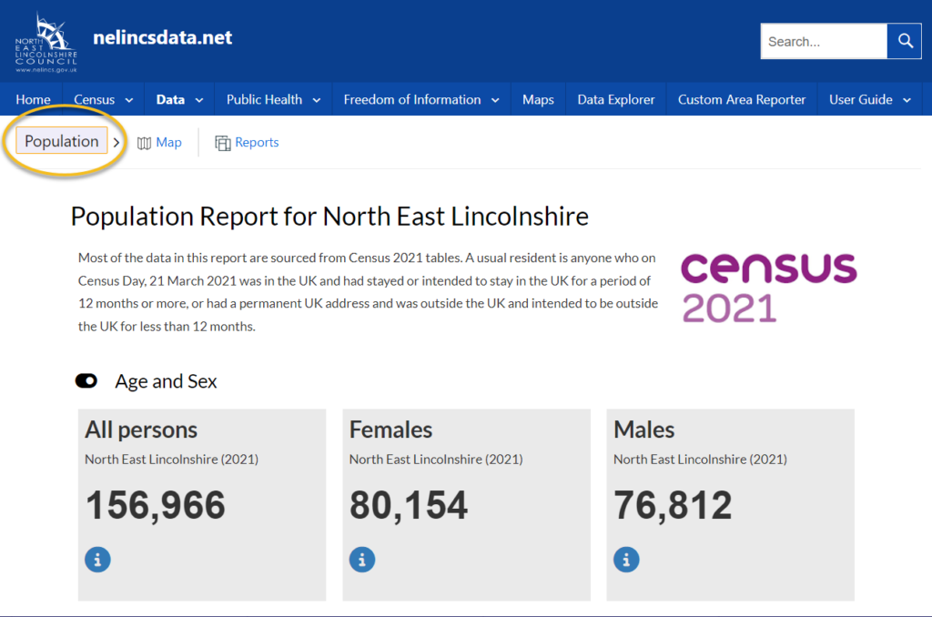
Data menu Population profile report default view North East Lincolnshire UTLA (see example below)
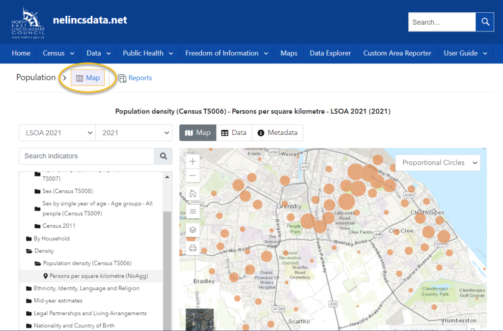
Data menu Population profile report > Map option According to the indicator chosen (see guidance below)
Data Explorer menu Search and filter indicators for data According to the indicator chosen (see guidance below)
Population profile report example
The same default report is available from the Population theme button on the home page or the Data > Population menu option.
Population Map Guidance
Data menu Population profile report > Map option
The selection of indicators is restricted to the set included in the Population theme.
Use the Data Explorer to select from the full range of indicators across all themes.
Data Explorer Guidance
The Census topic summary (TS) five-digit reference code, e.g. ‘Census TS001’ can be used as a search term.
Filters include:
- By theme and sub-theme, e.g. ‘Population – By Age and Sex – Age by single year of age – Age groups – All people (Census TS009)’.
- By geography ‘LSOA 2021’.
- By publisher ‘ONS – NOMIS, Esri UK’.