National Data Store geographies
The National Data Store provides data at the geographies shown in the hierarchy below.
- Country (England, Scotland and Wales)
- Region (Yorkshire and The Humber)
- Upper Tier Local Authority (UTLA) (North East Lincolnshire LA)
- Ward
- LSOA, ONS Census geography, lower layer super output area
- Selected areas. A selection of wards or LSOA divisions. Values are aggregated from the lower geographies to create values for the custom area.
The LSOA is the lowest level for which data is provided, however, the website provides lookups from LSOA to wards. For example, the West Marsh ward comprises of five LSOA sub-divisions.
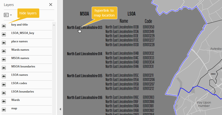
The website also provides lookups from LSOA to MSOA (ONS Census geography, middle layer super output area). Caution should be taken when using wards and MSOA divisions. This is because the area covered by MSOA divisions are not specifically aligned to ward boundaries.
Map boundaries with names and codes (PDF). Open the map in Adobe Acrobat to enable the layer and hyperlink features of this document.
Profile reports are available for these geographies:
- UTLA/LA
- Ward
- LSOA
- Selected areas (aggregated values)
Maps are available for these geographies:
- Country
- Region
- UTLA/LA
- Ward
- LSOA